

Map of Gintung Sub-Watershed
Landslide is the most damaging natural hazards in hilly and/or mountainous terrain environments. It becomes one of significant hazards in Indonesia. Steep slopes as the dominant topography construct Indonesia to prone to landslides. Moreover, high rainfall intensities enable to trigger the slope stability failure in particular sites. Consequently, Indonesia’s characteristics could create landslides easily.
One of areas frequently suffered by landslides is Gintung Sub-Watershed. Gintung Sub-Watershed (1,452.68 ha) is located in Purworejo Regency, among three districts such as Loano, Purworejo, and Kaligesing. Karnawati (2005) stated that Purworejo Regency has a high potential of landslides. Some of them were located in Gintung Sub-Watershed boundary. Numerous events in the study area could be used as the main indicator of high landslide potential.
Landslide occurrences are the proof that soil becomes insecure. Soil is anisotropic natural bodies (Schlichting, 1982; Sommer & Schlichting, 1996) which has specific capability on accommodating any activities on its surface. The number of landslide could be worse when land use activities do not fit with soil capability. Soil becomes the principal object of landslide event except slopes. The properties of soils vary with direction in catena. Assessment of the soil landscape sensitivity to further change must also take into account in both space and time.
Impacts of human activity are superimposed on soil properties changes. Soil dynamically changes either mechanically or chemically. Human impacts are most related to changing patterns of land use. Improper land uses could aggravate landslide potential. The significant condition of the study is the result of human-induced contributions for destabilizing slopes and threatening soil sustainability.
Appropriate land use planning becomes one of soil conservation strategies. Setting down a good recommendation of land use activities is a crucial aspect in soil sustainability consideration. The conservation guidelines could be made according to landslides distribution in the study area. Therefore, applying soil conservation strategy is expected to be a consideration for reducing significant landslide in that particular area.
Survey method was conducted to collect landslides distribution data. Direct checking to the field and gaining data from the institutions were carried out in this method. The aspects measured on field survey were landslide morphometric and landslide position. Moreover, map interpretation was also conducted to produce the tentative map. Topographycal map, geologycal map, and soil map were used to assist field surveying.
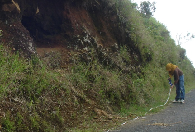
Landslide Morphometric and Position Measurement
Gintung Sub-Watershed has five main types of land use. Types of land use existed in the study area consist of bush, garden, paddy field, settlement, and dryland agriculture. Among those five land uses, garden is the most dominated land use in the study area. Almost the entire area of Gintung Sub-Watershed is covered by garden. There is 68% of Gintung Sub-Watershed covered by garden.
The highest of number density and area density of landslide is on settlement, 6.41 number/km2 and 79.21 millage. Landslide on the settlement area usually occurs along the road network. There is a lot of cutting slope for road construction, which is not suitable to the slope characteristic. This situation could aggravate slope failures, especially settlement on the steep relief. The steep slope area is easy to create prone slope stability. Therefore, steep slope enable to make landslide more intensive.

Steep Slope with Lithic Soil
The biggest number of landslide occurred on the garden, 45 points. Garden as the most dominated land uses should be developed by appropriate conservation strategy to keep the stability of slopes. Otherwise, the steep slope is easily to produce landslide prone area. The large area of garden makes its density of landslide is less dense than settlement.
Regarding to the cultivated land, paddy field has higher area density of landslide than dry land agriculture and bush have. This condition is caused by paddy field has greater wide area and wider landslide areas over dry land agriculture and bush. However, number density of landslide on paddy field is lower than the others. Therefore, based on this situation, it could be stated that the amount of landslides in particular variable class has not yet showed the wide area of landslide.

Proposed land uses for Gintung Sub-Watershed
Appropriate land use planning becomes one of soil conservation strategies from landslide impact. The changing in proposed land uses is occurred for other uses except settlement. The strategy to propose the land uses should be adjusted with the physical characteristics of particular area. Some gardens located in a lower slope should be changed into dryland agriculture, especially tumpangsari technique. In the upper slope of hilly, garden should be changed into conservative forest. In the middle slope of hilly, garden would be appropriate if it combines with shrub and bush. In addition, paddy field is appropiate to be planted in a flat up to undulating area.
Source:
Nur Ainun Pulungan, Chandra Setyawan, Sekar Jatiningtyas, Junun Sartohadi, Soil Conservation Strategy for Potentially Landslide Areas In Gintung Sub-Watershed, Central Java Province, Indonesia. Proceeding of International Symposium on Agricultural and Biosystem Engineering, Yogyakarta 2013.